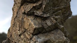
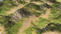
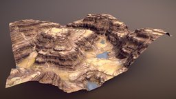
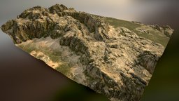
3D Erosion Models Free Download in various formats such as OBJ FBX STL DAE GLB ready to use for Unity/Blender/Maya/Cinema4D/Autodesk 3ds Max
RigModels.com Logo
100,000+ Free Models Search Engine.
Rig & Animate Models Automatically.
1000+ Animations for T-pose models.
Search 3D Models
Search
 + Advanced Search 

Sort By:


Erosion 3d models

(21 results)  
Page  1 

 
 Природная мос
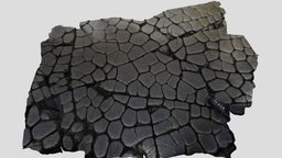
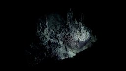
Природная мостовая на острове Кунашир coast, island, natural, columns, basalt, causeway, columnar-basalt, photogrammetry, 3dscan, columnar-joints, columnar-jointing, kurilskie-ostrova
Model's Description:
Природная мостовая на острове Кунашир 3D Model. Download Природная мостовая на острове Кунашир in various files formats such as Wavefront Object format, Autodesk FBX, DirectX 9.0, Stereo Lithography and HTML5 JSON format.
Обтёсанные эрозией столбчатые вулканические скалы на мысе Столбчатом (https://skfb.ly/6WsCN) на острове Кунашир образуют каменные мостовые природного происхождения. Подобные образования встречаются только в двух местах на планете: здесь и в Ирландии - Мостовая гигантов. Местоположение: https://yandex.ru/maps/-/CCUEIMaphB Natural causeway on the island of Kunashir Hewn by the erosion of columnar volcanic rocks at Cape Stolbchaty (https://skfb.ly/6WsCN) on Kunashir island form the stone pavements of natural origin. Such formations are found only in two places on the planet: here and in Ireland - the Giant’s Causeway. Location: https://goo.gl/maps/VfNUHBrLpfp8wcKH9 - Природная мостовая на острове Кунашир - Download Free 3D model by Mikhail Volkov (@mgv) 3D Model is ready to download for free, this model contains 99855 polygons.
 99,855 polygons  Download 
 
 Природная мос
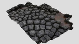
Природная мостовая на острове Кунашир (2) column, coast, island, natural, basalt, causeway, photogrammetry, 3dscan, columnar, columnar-jointing, columnar-joins
Model's Description:
Природная мостовая на острове Кунашир (2) 3D Model. Download Природная мостовая на острове Кунашир (2) in various files formats such as Wavefront Object format, Autodesk FBX, DirectX 9.0, Stereo Lithography and HTML5 JSON format.
Обтёсанные эрозией столбчатые вулканические скалы на мысе Столбчатом (https://skfb.ly/6WsCN) на острове Кунашир образуют каменные мостовые природного происхождения. Подобные образования встречаются только в двух местах на планете: здесь и в Ирландии - Мостовая гигантов. Местоположение: https://yandex.ru/maps/-/CCUEIMaphB Natural causeway on the island of Kunashir Hewn by the erosion of columnar volcanic rocks at Cape Stolbchaty (https://skfb.ly/6WsCN) on Kunashir island form the stone pavements of natural origin. Such formations are found only in two places on the planet: here and in Ireland - the Giant’s Causeway. Location: https://goo.gl/maps/VfNUHBrLpfp8wcKH9 - Природная мостовая на острове Кунашир (2) - Download Free 3D model by Mikhail Volkov (@mgv) 3D Model is ready to download for free, this model contains 99999 polygons.
 99,999 polygons  Download 
 
 The Columbarium, Petra, J
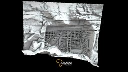
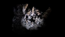
The Columbarium, Petra, Jordan zamaniproject, realitycapture
Model's Description:
The Columbarium, Petra, Jordan 3D Model. Download The Columbarium in various files formats such as Wavefront Object format, Autodesk FBX, DirectX 9.0, Stereo Lithography and HTML5 JSON format.
Petra is an Arabian city in the country of Jordan carved out of the sand-stone mountains in Wadi Araba. It was established over 2000 years ago and was the capital of the Nabataeans. The tombs and structures are now in danger of erosion due to earthquakes, floods and natural weathering and are thus in need of monitoring and documentation. 184 laser scans were captured for this site in 2013. The laser scanning survey of Petra, completed by the Zamani Project, is part of the Siq Stability project, which is a “Funds In Trust” project of the Italian Ministry of Foreign Affairs for UNESCO. It is managed by the UNESCO Amman Office and has as main partners Italian geological experts from ISPRA (Italian Institute for Environmental Protection and Research - Geological Survey of Italy), as well as geologists and a surveyor from the Petra National Trust. It is undertaken in cooperation with the Department of Antiquities of Jordan (DOA) and the Petra Development and Tourism Region Authority (PDTRA) 3D Model is ready to download for free, this model contains 316748 polygons.
 316,748 polygons  Download 
 
 Splitting Rivers Landscap
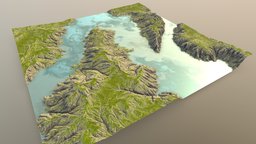
Splitting Rivers Landscape trees, world, sky, landscape, terrain, river, aerial, geology, earth, travel, water, nature, erosion, vista, rivers, splitting, ship, boat, diverge, forking
Model's Description:
Splitting Rivers Landscape 3D Model. Download Splitting Rivers Landscape in various files formats such as Wavefront Object format, Autodesk FBX, DirectX 9.0, Stereo Lithography and HTML5 JSON format.
Waters traveling in new directions, with Gaea and Substance Painter - Splitting Rivers Landscape - Buy Royalty Free 3D model by taber.noble 3D Model is ready to download for free, this model contains 332928 polygons.
 332,928 polygons  Download 
 
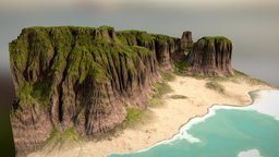
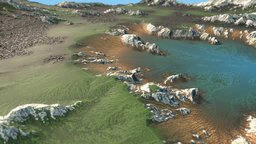
 Tropical Beach Cliffs
Tropical Beach Cliffs trees, world, sky, landscape, terrain, river, aerial, geology, earth, ocean, sand, dirt, view, vegetation, water, beach, erosion, cliffs, vista, gaea, substance, painter, blender, rock, sea
Model's Description:
Tropical Beach Cliffs 3D Model. Download Tropical Beach Cliffs in various files formats such as Wavefront Object format, Autodesk FBX, DirectX 9.0, Stereo Lithography and HTML5 JSON format.
Some lush and tropical sea cliffs for the win :-) With Gaea and Substance - Tropical Beach Cliffs - Buy Royalty Free 3D model by taber.noble 3D Model is ready to download for free, this model contains 520200 polygons.
 520,200 polygons  Download 
 
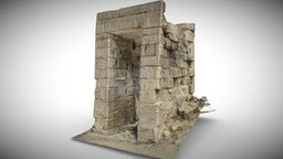
 Taharqa Gate (Before)
Taharqa Gate (Before) egyptology, luxor, medinet_habu, oriental_institute, chicago_house, epigraphic_survey, small_amun_temple
Model's Description:
Taharqa Gate (Before) 3D Model. Download Taharqa Gate (Before) in various files formats such as Wavefront Object format, Autodesk FBX, DirectX 9.0, Stereo Lithography and HTML5 JSON format.
Taharqa Gate Conservation The Taharqa Gate is situated in what would have been the northern mudbrick enclosure wall of the Small Amun Temple at Medinet Habu. In the aftermath of the destruction of the Temple Area and walls of Ramses III at Medinet Habu, the Ethiopian Kings of the 25th dynasty undertook reconstruction efforts, rebuilding a mudbrick wall encircling the small temple upon the foundations of a wall of the same dimensions erected by Hatshepsut. With these massive mudbrick enclosure walls all but weathered away, the gate now appears as a free standing structure. However, the lack of surrounding mudbrick structural support it had when built, combined with 2000 years of erosion have left the gate in need of urgent attention. Further reading and image Ref.: The Excavation of Medinet Habu - VII MHE 085/086 Project: The Epigraphic Survey in collaboration with the MoTA - Taharqa Gate (Before) - 3D model by Chicago House (@chicagohouse) 3D Model is ready to download for free, this model contains 749999 polygons.
 749,999 polygons  Download 
 
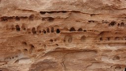
 Petra rock wall
Petra rock wall petra, erosion, rock
Tags:  petra 

erosion 

rock 

Model's Description:
Petra rock wall 3D Model. Download Petra rock wall in various files formats such as Wavefront Object format, Autodesk FBX, DirectX 9.0, Stereo Lithography and HTML5 JSON format.
On the high place trail, this eroded rock wall caught my eye. Approximate size: 3-4ft - Petra rock wall - 3D model by mattdev 3D Model is ready to download for free, this model contains 243712 polygons.
 243,712 polygons  Download 
 
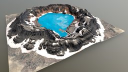
 Crater Lake Terrain
Crater Lake Terrain world, sky, landscape, wind, dune, terrain, land, aerial, lake, geology, snow, earth, wet, pool, color, water, cold, volcano, frozen, crater, erosion, salt, vista, gaea, substance, painter, rock, rockslide
Model's Description:
Crater Lake Terrain 3D Model. Download Crater Lake Terrain in various files formats such as Wavefront Object format, Autodesk FBX, DirectX 9.0, Stereo Lithography and HTML5 JSON format.
A distant crater lake filled with all kinds of alkaline water qualities, with Gaea and Substance Painter! PBR Material set to 4K - Crater Lake Terrain - Buy Royalty Free 3D model by taber.noble 3D Model is ready to download for free, this model contains 498002 polygons.
 498,002 polygons  Download 
 
 Low Poly Deep Sea Hydroth
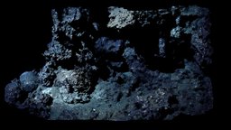
Low Poly Deep Sea Hydrothermal Vent #7 film, plants, organic, white, underwater, growth, geology, shipwreck, wreck, deepsea, aircraft, nature, brine, erosion, vents, houdini, hydrothermal, underwaterarchaeology, methane, realitycapture, photogrammetry, 3d, 3dsmax, blender, lowpoly, low, poly, structure, ship, 3dmodel, 3dmodeling, sea, brinepools, hydrothermalvents, blacksmoker, whitesmoker, underwaterarcheology, aircraftwreck
Model's Description:
Low Poly Deep Sea Hydrothermal Vent #7 3D Model. Download Low Poly Deep Sea Hydrothermal Vent #7 in various files formats such as Wavefront Object format, Autodesk FBX, DirectX 9.0, Stereo Lithography and HTML5 JSON format.
Model 02: Hydrothermal vent A black smoker is a kind of hydrothermal vent that can be found on the ocean floor. It is a crack in the planet’s surface from which geothermally heated water comes out. Hydrothermal vents are commonly found near volcanically active places, areas where tectonic plates are moving apart, ocean basins, and hotspots. Hydrothermal vents are common on earth because it is both geologically active and has large amounts of water on its surface and within its crust. Common land types include hot springs, fumaroles and geysers. Can be used perfectly as atmospheric back-and-foreground models for deep sea 3d environments. Works also very well with kitbashing techniques Purchase of this model includes: 3d model and textures: Size: 34mb Format: .obj Vertices: 83.4k 1x5K ambient occlusion map 1x5K color map 1x5K curvature map 1x5K normal map 1x5K rougness map Any questions, feel free to contact me on https://jorisputteneers.tumblr.com/ - Low Poly Deep Sea Hydrothermal Vent #7 - Buy Royalty Free 3D model by jorisputteneers 3D Model is ready to download for free, this model contains 165274 polygons.
 165,274 polygons  Download 
 
 Low Poly Deep Sea Shipwre
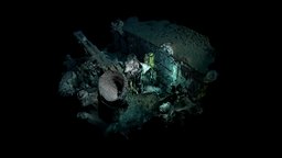
Low Poly Deep Sea Shipwreck #2 film, organic, white, underwater, geology, shipwreck, wreck, deepsea, coral, craft, cgi, deep, aircraft, science, nature, saltwater, brine, vent, buy, strucure, erosion, vents, salt, hydrothermal, smoker, pools, realitycapture, photogrammetry, scan, air, technology, ship, 3dmodel, black, 3dmodeling, sea, brinepools, hydrothermalvents, blacksmoker, "whitesmoker"
Model's Description:
Low Poly Deep Sea Shipwreck #2 3D Model. Download Low Poly Deep Sea Shipwreck #2 in various files formats such as Wavefront Object format, Autodesk FBX, DirectX 9.0, Stereo Lithography and HTML5 JSON format.
**Model 09: Deepsea shipwreck ** USS Independence is a United States Navy light aircraft carrier, lead ship of her class and served during World War II. Converted from the hull of a cruiser, she was built by the New York Shipbuilding Corporation and commissioned in January 1943. She took part in the attacks on Rabaul and Tarawa before being torpedoed by Japanese aircraft, necessitating repairs in San Francisco from January to July 1944. Can be used perfectly as atmospheric back-and-foreground models for deep sea 3d environments. Works also very well with kitbashing techniques Purchase of this model includes: 3d model and textures: Size: 28mb Format: .obj Vertices: 101k 1x5K ambient occlusion map 1x5K color map 1x5K curvature map 1x5K normal map 1x5K rougness map Any questions, feel free to contact me on https://jorisputteneers.tumblr.com/ - Low Poly Deep Sea Shipwreck #2 - Buy Royalty Free 3D model by jorisputteneers 3D Model is ready to download for free, this model contains 201159 polygons.
 201,159 polygons  Download 
 
 Low Poly Deep Sea Hydroth
Low Poly Deep Sea Hydrothermal Vent #6 film, white, underwater, geology, tech, deepsea, coral, cgi, science, reef, saltwater, brine, vent, coralreef, erosion, vents, houdini, hydrothermal, underwaterarchaeology, methane, hydro, underwaterphotogrammetry, render, 3d, 3dsmax, blender, lowpoly, scan, 3dmodel, 3dmodeling, hydrothermalvents, blacksmoker, whitesmoker
Model's Description:
Low Poly Deep Sea Hydrothermal Vent #6 3D Model. Download Low Poly Deep Sea Hydrothermal Vent #6 in various files formats such as Wavefront Object format, Autodesk FBX, DirectX 9.0, Stereo Lithography and HTML5 JSON format.
Model 07: Hydrothermal vent** A black smoker is a kind of hydrothermal vent that can be found on the ocean floor. It is a crack in the planet’s surface from which geothermally heated water comes out. Hydrothermal vents are commonly found near volcanically active places, areas where tectonic plates are moving apart, ocean basins, and hotspots. Hydrothermal vents are common on earth because it is both geologically active and has large amounts of water on its surface and within its crust. Common land types include hot springs, fumaroles and geysers. Can be used perfectly as atmospheric back-and-foreground models for deep sea 3d environments. Works also very well with kitbashing techniques Purchase of this model includes: 3d model and textures: Size: 43mb Format: .obj Vertices: 100k 1x5K ambient occlusion map 1x5K color map 1x5K curvature map 1x5K normal map 1x5K rougness map Any questions, feel free to contact me on https://jorisputteneers.tumblr.com/ - Low Poly Deep Sea Hydrothermal Vent #6 - Buy Royalty Free 3D model by jorisputteneers 3D Model is ready to download for free, this model contains 198846 polygons.
 198,846 polygons  Download 
 
 Low Poly Deep Sea Hydroth
Low Poly Deep Sea Hydrothermal Vent #9 film, plants, organic, white, underwater, geology, deepsea, crab, deep, water, nature, photoscanning, saltwater, crabs, erosion, vents, salt, houdini, hydrothermal, smoker, methane, hydro, realitycapture, photogrammetry, 3d, 3dsmax, blender, texture, lowpoly, low, poly, scan, stone, structure, 3dmodel, blue, steam, black, sea, "blacksmoker", "whitesmoker", "hydrothermavents"
Model's Description:
Low Poly Deep Sea Hydrothermal Vent #9 3D Model. Download Low Poly Deep Sea Hydrothermal Vent #9 in various files formats such as Wavefront Object format, Autodesk FBX, DirectX 9.0, Stereo Lithography and HTML5 JSON format.
Model 14: Deep sea surface A black smoker is a kind of hydrothermal vent that can be found on the ocean floor. It is a crack in the planet’s surface from which geothermally heated water comes out. Hydrothermal vents are commonly found near volcanically active places, areas where tectonic plates are moving apart, ocean basins, and hotspots. Hydrothermal vents are common on earth because it is both geologically active and has large amounts of water on its surface and within its crust. Common land types include hot springs, fumaroles and geysers. Can be used perfectly as atmospheric back-and-foreground models for deep sea 3d environments. Works also very well with kitbashing techniques Purchase of this model includes: 3d model and textures: Size: 23mb Format: .obj Vertices: 118k 1x5K ambient occlusion map 1x5K color map 1x5K curvature map 1x5K normal map 1x5K rougness map Any questions, feel free to contact me on https://jorisputteneers.tumblr.com/ - Low Poly Deep Sea Hydrothermal Vent #9 - Buy Royalty Free 3D model by jorisputteneers 3D Model is ready to download for free, this model contains 235250 polygons.
 235,250 polygons  Download 
 
 Low Poly Deep Sea Shipwre
Low Poly Deep Sea Shipwreck #3 wheel, film, plants, organic, scanning, white, underwater, geology, shipwreck, deepsea, coral, cgi, deep, hydrant, nature, saltwater, erosion, atmosphere, vents, salt, houdini, hydrothermal, underwaterarchaeology, deepwater, deep-sea, ventspils, pools, realitycapture, texturing, photogrammetry, 3d, 3dsmax, blender, lowpoly, structure, 3dmodel, black, sea, brinepools, "hydrothermalvents", "whitesmoker", "3dmedling"
Model's Description:
Low Poly Deep Sea Shipwreck #3 3D Model. Download Low Poly Deep Sea Shipwreck #3 in various files formats such as Wavefront Object format, Autodesk FBX, DirectX 9.0, Stereo Lithography and HTML5 JSON format.
**Model 11: Deepsea shipwreck ** USS Independence is a United States Navy light aircraft carrier, lead ship of her class and served during World War II. Converted from the hull of a cruiser, she was built by the New York Shipbuilding Corporation and commissioned in January 1943. She took part in the attacks on Rabaul and Tarawa before being torpedoed by Japanese aircraft, necessitating repairs in San Francisco from January to July 1944. Can be used perfectly as atmospheric back-and-foreground models for deep sea 3d environments. Works also very well with kitbashing techniques Purchase of this model includes: 3d model and textures: Size: 28mb Format: .obj Vertices: 139.6k 1x5K ambient occlusion map 1x5K color map 1x5K curvature map 1x5K normal map 1x5K rougness map Any questions, feel free to contact me on https://jorisputteneers.tumblr.com/ - Low Poly Deep Sea Shipwreck #3 - Buy Royalty Free 3D model by jorisputteneers 3D Model is ready to download for free, this model contains 278032 polygons.
 278,032 polygons  Download 
 
 Sea stack 3D Game ready a
Sea stack 3D Game ready asset landscape, capture, terrain, scanning, exterior, materials, reality, coast, classic, beach, nature, stack, erosion, gamereadyasset, pbr-texturing, photogrammetry, game, 3d, art, texture, pbr, gameart, low, poly, model, scan, rock, material, sea, gameready, environment
Model's Description:
Sea stack 3D Game ready asset 3D Model. Download Sea stack 3D Game ready asset in various files formats such as Wavefront Object format, Autodesk FBX, DirectX 9.0, Stereo Lithography and HTML5 JSON format.
3D scan conformed for real-time use, PBR materials constructed with the help of Unity’s De-Lighting app. Shot in bright sunshine on location near Malin Head, Donegal, Ireland. To find out more about how this was put together, check out www.petemcnally.com - Sea stack 3D Game ready asset - Buy Royalty Free 3D model by petemc 3D Model is ready to download for free, this model contains 9947 polygons.
 9,947 polygons  Download 
 
 Grassy Mountain 01
Grassy Mountain 01 terrain, mountain, worldmachine, nature, erosion, highland, grasslands, game, environment
Model's Description:
Grassy Mountain 01 3D Model. Download Grassy Mountain 01 in various files formats such as Wavefront Object format, Autodesk FBX, DirectX 9.0, Stereo Lithography and HTML5 JSON format.
Grassy Mountain 01 - Grassy Mountain 01 - 3D model by Leaf (@leafada) 3D Model is ready to download for free, this model contains 260642 polygons.
 260,642 polygons  Download 
 
 Dotted Lake Canyon
Dotted Lake Canyon world, sky, landscape, wind, red, terrain, canyon, aerial, lake, desert, geology, earth, sand, dirt, pond, water, warm, erosion, skybox, chasm, arid, vista, rock, dotted
Model's Description:
Dotted Lake Canyon 3D Model. Download Dotted Lake Canyon in various files formats such as Wavefront Object format, Autodesk FBX, DirectX 9.0, Stereo Lithography and HTML5 JSON format.
One more canyon piece for the win! Made with Gaea and Substance Painter - Dotted Lake Canyon - Buy Royalty Free 3D model by taber.noble 3D Model is ready to download for free, this model contains 403202 polygons.
 403,202 polygons  Download 
 
 Winding Chasm Badlands
Winding Chasm Badlands trees, world, sky, landscape, terrain, land, aerial, desert, rocks, geology, natural, view, nature, dry, winding, erosion, weather, chasm, cliffs, woah, arid, vista, badlands, flooded, windy, rock
Model's Description:
Winding Chasm Badlands 3D Model. Download Winding Chasm Badlands in various files formats such as Wavefront Object format, Autodesk FBX, DirectX 9.0, Stereo Lithography and HTML5 JSON format.
Winding Chasm badlands, with a bit more dryness! Gaea and Substance Painter :) Materials set to 4K, Thanks for viewing! - Winding Chasm Badlands - Dry - Buy Royalty Free 3D model by taber.noble 3D Model is ready to download for free, this model contains 336200 polygons.
 336,200 polygons  Download 
 
 Magic Valley
Magic Valley tree, landscape, snow, water, erosion
Tags:  tree 

landscape 

snow 

water 

erosion 

Model's Description:
Magic Valley 3D Model. Download Magic Valley in various files formats such as Wavefront Object format, Autodesk FBX, DirectX 9.0, Stereo Lithography and HTML5 JSON format.
Simple landscape experiment 3D Model is ready to download for free, this model contains 126002 polygons.
 126,002 polygons  Download 
 
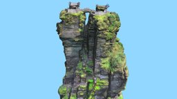
 Fanjing Mountain, Guizhou
Fanjing Mountain, Guizhou, China three, mountain, china, heritage, climbing, tourism, tourist, buddhist, valleys, maitreya, photogrammetry, sport, temple, zhejiang, sakyamuni, fanjing, guizhou
Model's Description:
Fanjing Mountain, Guizhou, China 3D Model. Download Fanjing Mountain in various files formats such as Wavefront Object format, Autodesk FBX, DirectX 9.0, Stereo Lithography and HTML5 JSON format.
Fanjing Mountain, formerly known as “Three Valleys”, is located in Tongren City, Guizhou Province, and is named after “Brazil Pure Land”. Fanjing Mountain has won the “China’s Top Ten Summer Mountain” in 2008 and 2009, and is the fifth largest Buddhist mountain in China with Wutai Mountain in Shanxi, Putuo Mountain in Zhejiang, Mount Emei in Sichuan and Jiuhua Mountain in Anhui. Fanjing Mountain has abundant wildlife resources, such as rare golden monkeys and phoenix trees. In the mountains, you can’t find the traces of artificial scenery. The “Mushroom Stone” of the main peak is a famous landscape, and it is also a rare place for tourism. The ‘golden dome’ stands on a narrow ridge with a height difference of several hundred meters. Under the weathering erosion, the hard rock body cracks to form a crevice, so the ‘golden dome’ is divided into two. People built a temple on each of the two peaks, the Sakyamuni temple on the left and the Maitreya temple on the right. Source: chinesewishes.com - Fanjing Mountain, Guizhou, China - Buy Royalty Free 3D model by LibanCiel 3D Model is ready to download for free, this model contains 811128 polygons.
 811,128 polygons  Download 
 
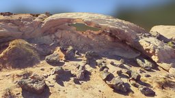
 Moonrise Arch -- Escalant
Moonrise Arch -- Escalante Area, UT geology, arch, utah, photogrammetry, rock
Tags:  geology 

arch 

utah 

photogrammetry 

rock 

Model's Description:
Moonrise Arch -- Escalante Area, UT 3D Model. Download Moonrise Arch -- Escalante Area in various files formats such as Wavefront Object format, Autodesk FBX, DirectX 9.0, Stereo Lithography and HTML5 JSON format.
Moonrise Arch is located near its more-famous neighbor, Sunset Arch, along Hole-in-the-Rock Road south of Escalante, Utah. Evidence of recent rockfall is found piled below the arch, along with iron-rich boulders that may once have protected the underlying Navajo sandstone from erosion 3D Model is ready to download for free, this model contains 93532 polygons.
 93,532 polygons  Download 
 
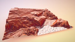
 Flowing Sandstone Hills
Flowing Sandstone Hills world, sky, landscape, wind, red, terrain, land, aerial, desert, geology, earth, adventure, rolling, sandstone, dry, erosion, hills, arid, vista, pits, stone, rock
Model's Description:
Flowing Sandstone Hills 3D Model. Download Flowing Sandstone Hills in various files formats such as Wavefront Object format, Autodesk FBX, DirectX 9.0, Stereo Lithography and HTML5 JSON format.
Igneous-type sandstone terrain with blowing sand to go with the whole picture. Hit the dusty trail sometime! Thanks for viewing :) - Flowing Sandstone Hills - Buy Royalty Free 3D model by taber.noble 3D Model is ready to download for free, this model contains 316808 polygons.
 316,808 polygons  Download 
 
...


Download Free 3D Models - Animated Models - Privacy Policy - RSS
Copyright © 2017-2025 RigModels. All rights reserved.
Contact Info